Coronavirus resources: Data, maps and more

The coronavirus pandemic has generated a flood of data, maps and other resources to track the spread — and places to get help — throughout the region.
Many of these resources are scattered across different websites and dashboards. Here’s a brief summary of what’s available, collected in one place. We will update this list as the pandemic goes on:
Tracking the spread throughout the Charlotte region
The UNC Charlotte Urban Institute has been tracking the total number and cases per 100,000 residents in the 14-county region the institute serves through an interactive map.
Food resources
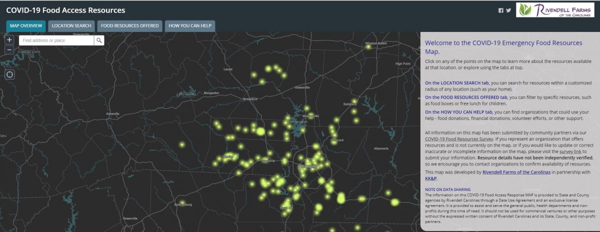
With people struggling to feed their families amidst lost jobs and closed schools, Rivendell Farms of the Carolinas created an Emergency COVID-19 Food Access Resource Map. The map has details about both places people in need can get food and places you can donate to help people who need food.
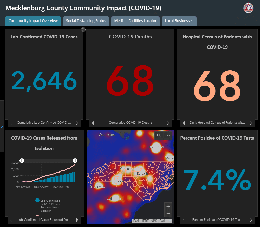
Mecklenburg County dashboard
The county is providing regular data updates through a dashboard updated daily. The data include daily case counts, hospitalizations, deaths and the status of local businesses.
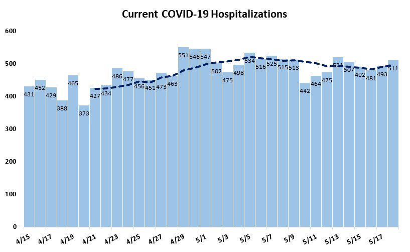
NC statewide dashboard
The N.C. Department of Health and Human Services maintains a dashboard updated daily with information on case counts by zip code to hospitalizations to deaths throughout the state.
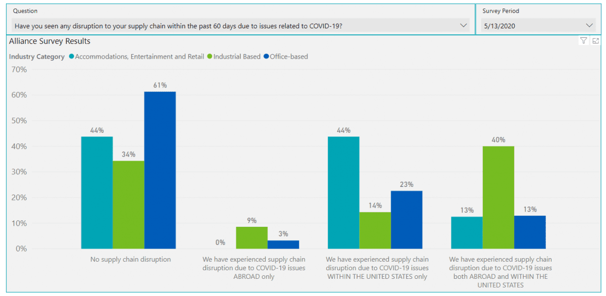
Business and resident sentiment
The Charlotte Regional Research Collaborative, led by the Charlotte Regional Business Alliance, is publishing a COVID-19 dashboard. It includes everything from survey data about supply chain disruptions to unemployment claims to hotel occupancy, and covers Charlotte-region counties in North Carolina and South Carolina.
SC statewide dashboard
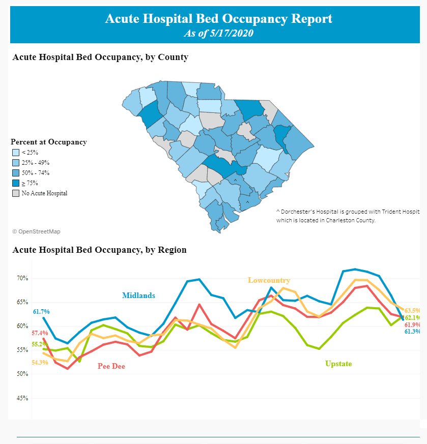
South Carolina Department of Health and Environmental Control publishes data including cases by county and zip code, demographics and hospital bed occupancy.

